
In between two small towns in Eastern Idaho, a no-longer-needed path has a new lease on life. Ride/bike/walk between two towns and enjoy epic scenery consisting of farms, creeks and the impressive Teton Mountain Range.
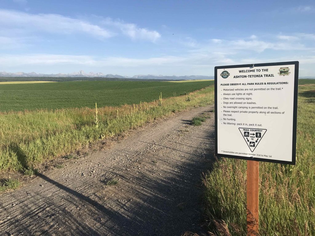
The Ashton to Tetonia Trail covers the 30 miles between, you guessed it, Ashton (population 1,060) and Tetonia (population 282). The path is loose gravel pack and approximately 10 feet wide. Tetonia has a slightly higher elevation than Ashton, but it is pretty level so you don’t have to worry about steep inclines and declines. Visitors enjoy this trail on four legs (horseback), two wheels (biking) or two feet (walking). Or any other combination of legs, wheels and feet.
State Park Overview
Overall, we give this state park (aka trail) five stars.
Similar to the Hiawatha Trail in Northern Idaho and the Weiser Trail in Western Idaho, the Ashton to Tetonia Trail shows that we don’t have to disregard everything from our past, but instead we can reduce, reuse and recycle.
Pros:
- Eye-popping scenery
- No crazy climbs or mountains that you have to power up
- Not a lot of people
Cons:
- It’s a challenge to find the path if you want to start somewhere in the middle
- No bathrooms along the way (that we saw)
What To Do
This trail is a gravel path, so the only thing you can do is…go down it. How you do that depends on your preferred mode of transport. Motorized vehicles are not allowed so you can ride a bike, ride a horse or walk/run. The best part of what you do on the trail is to see some incredibly beautiful country.
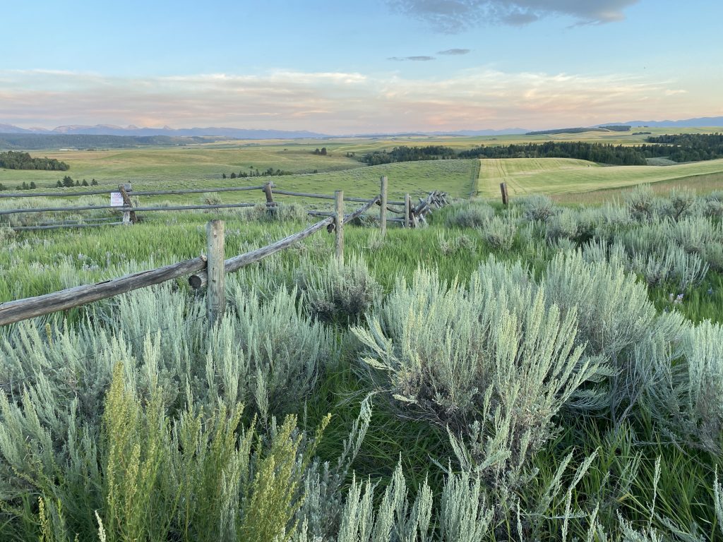
This part of Idaho is rural, so in between the two towns you’ll see rolling hills of wheat fields. I was actually surprised by the rolling hills part. I have only seen one other area of Idaho that looks like this, the Palouse over on the Washington border. The real showstopper, though, is the Teton Mountain Range. Most people recognize the name ‘Teton’ from Teton National Park in Wyoming. That side of the mountain range is also very nice, but the Idaho side is no slouch. If you travel south from Ashton to Tetonia, the Tetons will be your beacon as you journey along.
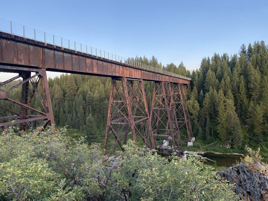
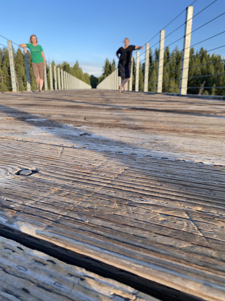
Along the path are a couple of trestles, which are really cool bridges that the trains would cross to get over creeks and canyons. If you are only doing part of the trail, make sure you cross at least one.
Amenities
Well, it’s a gravel path. There are some benches every so often, but you are basically fending for yourself. We didn’t see any restrooms where we were, but the maps on the Idaho Parks website shows there is one at the beginning, end and somewhere in the middle.
The Crowd Situation
The main parking areas along with the path will have the most people. We opted to do a part in the middle of the path and saw no one. Not a single soul. But on the drive to our starting spot we passed the parking lot that was about ¾ full. It was a pretty small lot though, so that was probably around 15 cars.
Unique to Ashton to Tetonia Trail
As mentioned above, the Ashton to Tetonia Trail is similar to the Hiawatha and Weiser trails but in the big scheme of things, there aren’t many trails like this around. There really should be though, because trails like this are an epic way to be able to explore country you normally wouldn’t get to see by car.
A Little History about the Ashton to Tetonia Trail
The Oregon Short Line Railroad was built in 1912. It connected people from Salt Lake all the way up to the dude ranches around near current day Yellowstone. The rail worked hard for the next seven decades, but was decommissioned in 1984. The land was repurposed in 2010 when it became the Ashton to Tetonia Trail.
Explore Nearby
- Teton National Park
- Island Park, Idaho
- Harriman State Park
Our experience(s) at the Ashton to Tetonia Trail
Finding a spot
We didn’t want to haul our bikes on this trip, so we planned to just enjoy the Ashton to Tetonia Trail on our feet. I had Googled ‘best part of Ashton to Tetonia Trail to hike’ and to be perfectly honest, there wasn’t a lot of suggestions. If my search results were indicative of how this trail is used, most people bike it. I knew I wanted to go over a trestle, so I narrowed down the few results I found and planned our course for the Bitch Creek stretch. TBH, I thought the name was pretty funny and that might have influenced my decision.
I had found a page on the interwebs that explained how to get to Bitch Creek from Tetonia. The coordinates were in the directions so I popped those into Google Maps and figured we’d get to the same place. We did not. I’m not complaining though, because the road between Ashton and our GPS coordinates was stunning. We drove about 12 miles south of Ashton and then turned a few times and ended up in the middle of a few fields at a private entrance to a ranch. We had crossed over the Ashton to Tetonia Trail just before the dead end and we figured since no one probably going to be in that particular field, we’d just park and start our walk from there. This was somewhere around the mile marker 17 (There are mile markers along the trail.)
Heading down the trail
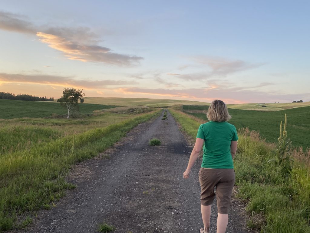
The trail was a nice easy grade and we saw wheat fields in different shades of green and yellow. Lupine and fireweed were all over in the ditches next to the trail. As we got closer to the creek we entered an Aspen grove and then right around the creek we found ourselves in the thick of a pine forest.
The wooden trestle was very impressive. There was a nice open walking path with gated sides so you didn’t feel like you were going to plummet to your death. You are really high on this trestle, so if heights are scary to you, maybe stick to the middle and don’t look down. Right around this time the sun decided to set, so not only were we treated to gorgeous scenery, we were treated to gorgeous scenery bathed in lush lighting. The sky turned orange, the Tetons pink and wheat even more golden.
As we headed back we still had enough light to see the path. Be advised though, if you go for a sunset stroll on the Ashton to Tetonia Trail, bring bug spray. We each got bit several times by the dastardly mozzies.
Conclusion
The Asthon to Tetonia Trail is the lesser known cousin to the Hiawatha. As such, there are fewer people on it and who know of it. Just the way I like things! So before the secret gets out, explore this trail and enjoy the splendor of the Tetons.
We visited the Ashton to Tetonia Trail as part of our Idaho State Parks Challenge. The challenge consists of visiting all of Idaho’s state parks in one year. We made up this challenge to see a bit more of our beautiful state and help alleviate the restlessness caused by Covid-19 travel restrictions. Feel free to join the challenge!
Related posts you might like:
Or if you want to see all of our posts, visit Past Posts.
Leave a Reply